Publications / 2026
Mono-Hydra++: Real-Time Monocular Scene Graph Construction with Multi-Task Learning for 3D Indoor Mapping
ISPRS Journal of Photogrammetry and Remote Sensing, 2026
Under review at ISPRS Journal of Photogrammetry and Remote Sensing. Manuscript number PHOTO-S-26-02536.
A single camera and an IMU build a hierarchical metric-semantic 3D scene graph of an indoor building in real time, and the map is accurate to 0.08 m.
Context
Metric-semantic mapping systems that produce usable scene graphs have almost always assumed RGB-D or LiDAR input, because reliable geometry is the hard part and depth sensors supply it directly. That assumption rules out the platforms where mapping is most useful, since payload and power are what limit small drones. Mono-Hydra++ removes the depth sensor and closes the loop between perception and state estimation instead.
Contribution
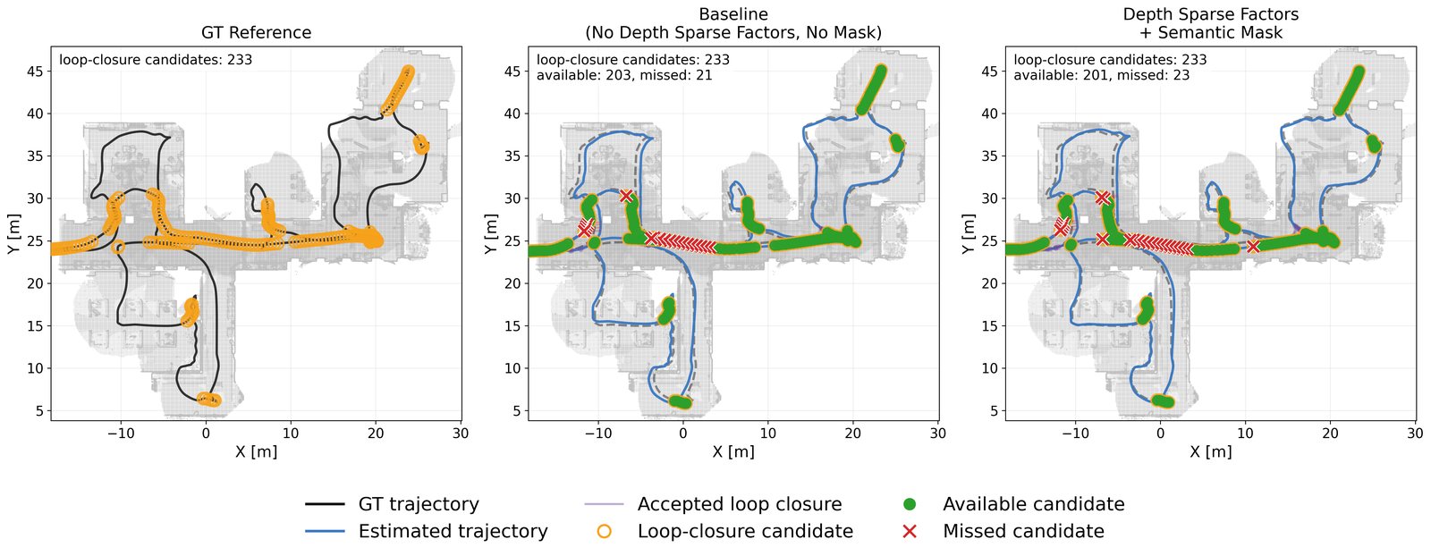
Predicted sparse depth is fed back into the VIO as metric anchor factors, semantic masks exclude dynamic and unreliable regions from the estimator, and the estimated poses align the dense predictions in time. Each direction of that loop is ablated separately. The components are measured inside the running system, so the comparison does not isolate what any single one contributes on its own.
Architecture / Mono-Hydra++
Trace a camera frame through the mapping stack.
RGB and IMU measurements become depth, semantic labels, motion estimates, refined poses and a hierarchical map.
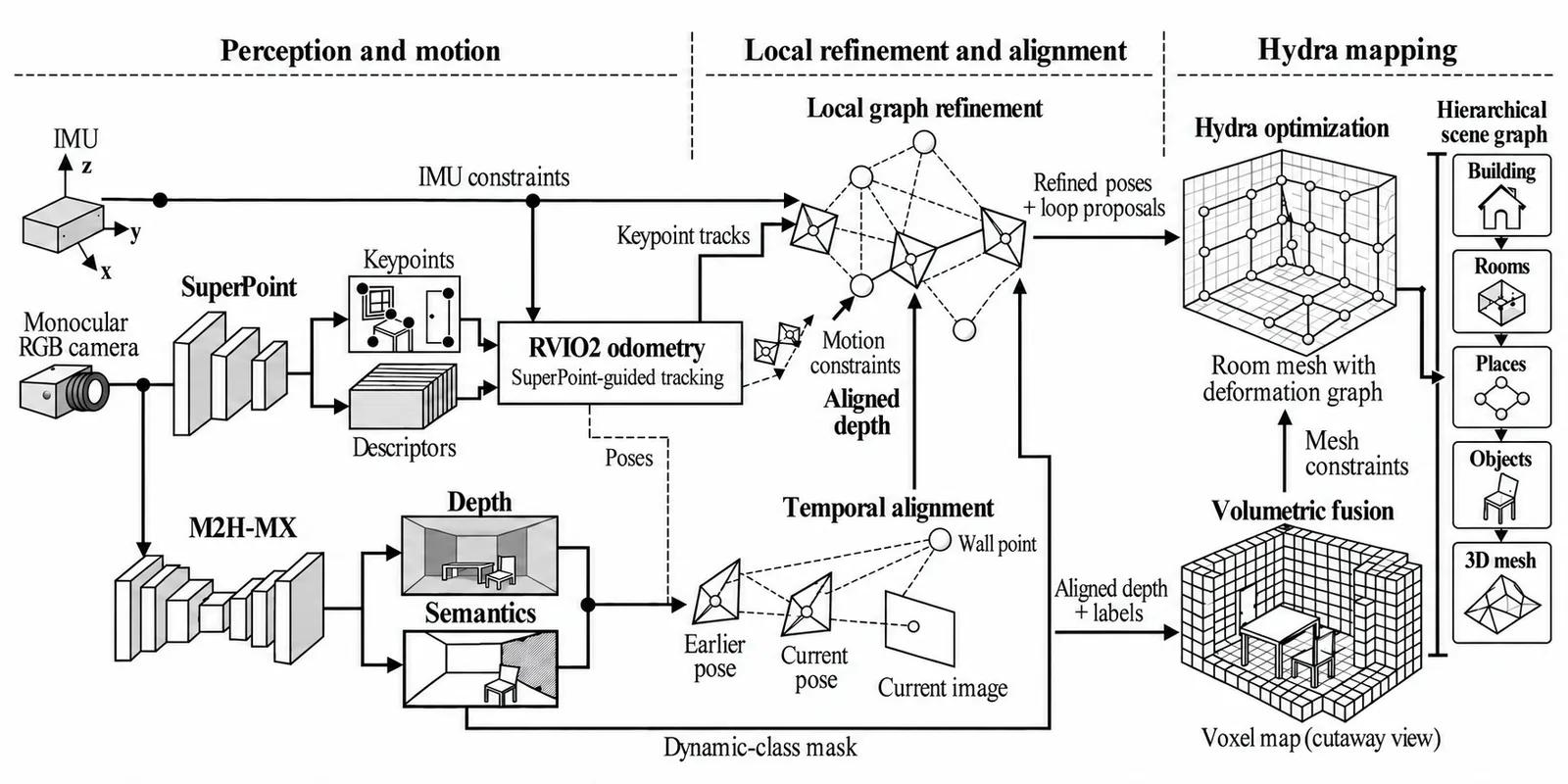
01 / Inside Mono-Hydra++
Align predictions before fusing the map.
A pixel in the previous frame does not refer to the same scene point after the camera moves. RVIO2 relative poses warp historical depth and labels into the current view. The nearest sample is retained at each pixel; accepted history is fused with the current prediction using depth medians and label voting.
The output is aligned depth and labels for local graph refinement and volumetric fusion.
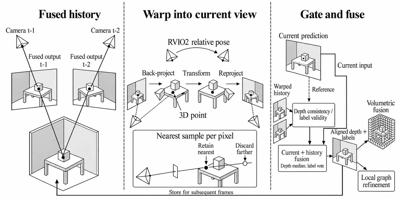
02 / Inside Mono-Hydra++
Turn selected depth samples into pose constraints.
Aligned depth is sampled at tracked keypoints. Depth validity, motion, reprojection and semantic checks select the samples that can become depth factors. These enter local graph refinement alongside visual tracks, RVIO2 motion and IMU constraints.
Refined poses and loop-closure proposals are passed to Hydra, which optimises the map and updates the scene graph.
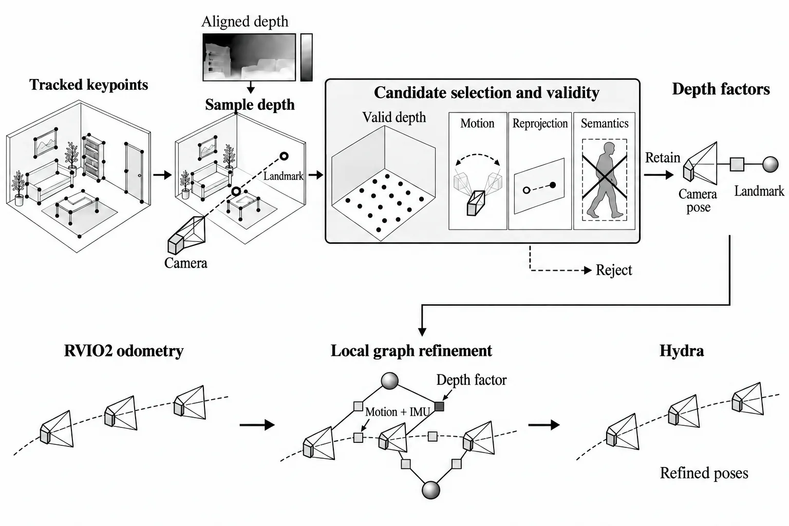
03 / Inside Mono-Hydra++
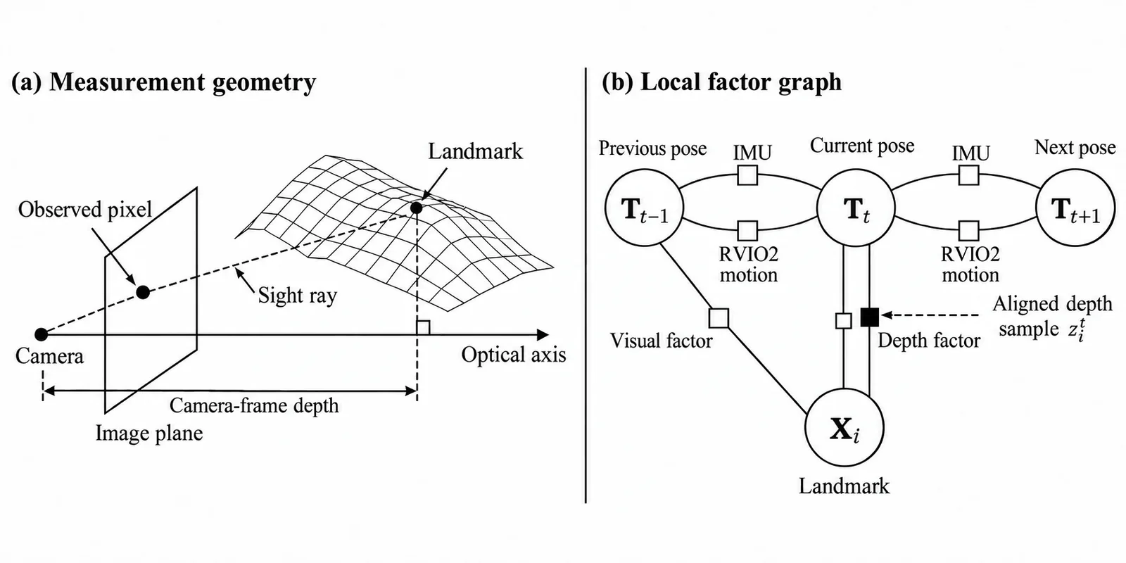
Constrain optical-axis depth in the local graph.
The depth measurement is camera-frame distance along the optical axis. A depth factor connects a camera pose and a tracked landmark; visual, motion and IMU factors provide complementary constraints.
The illustration omits velocity and bias variables to make the pose–landmark relationship easier to read.
Results
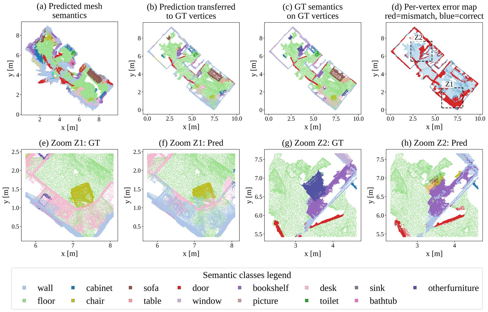
- 0.08 m mesh mean error, ITC building 2nd floor M2H-MX-L front end, 640x480, RTX 4080 Super
- 0.033 m calibrated average ATE RMSE on 7-Scenes ScanNet-trained weights, RGB plus IMU
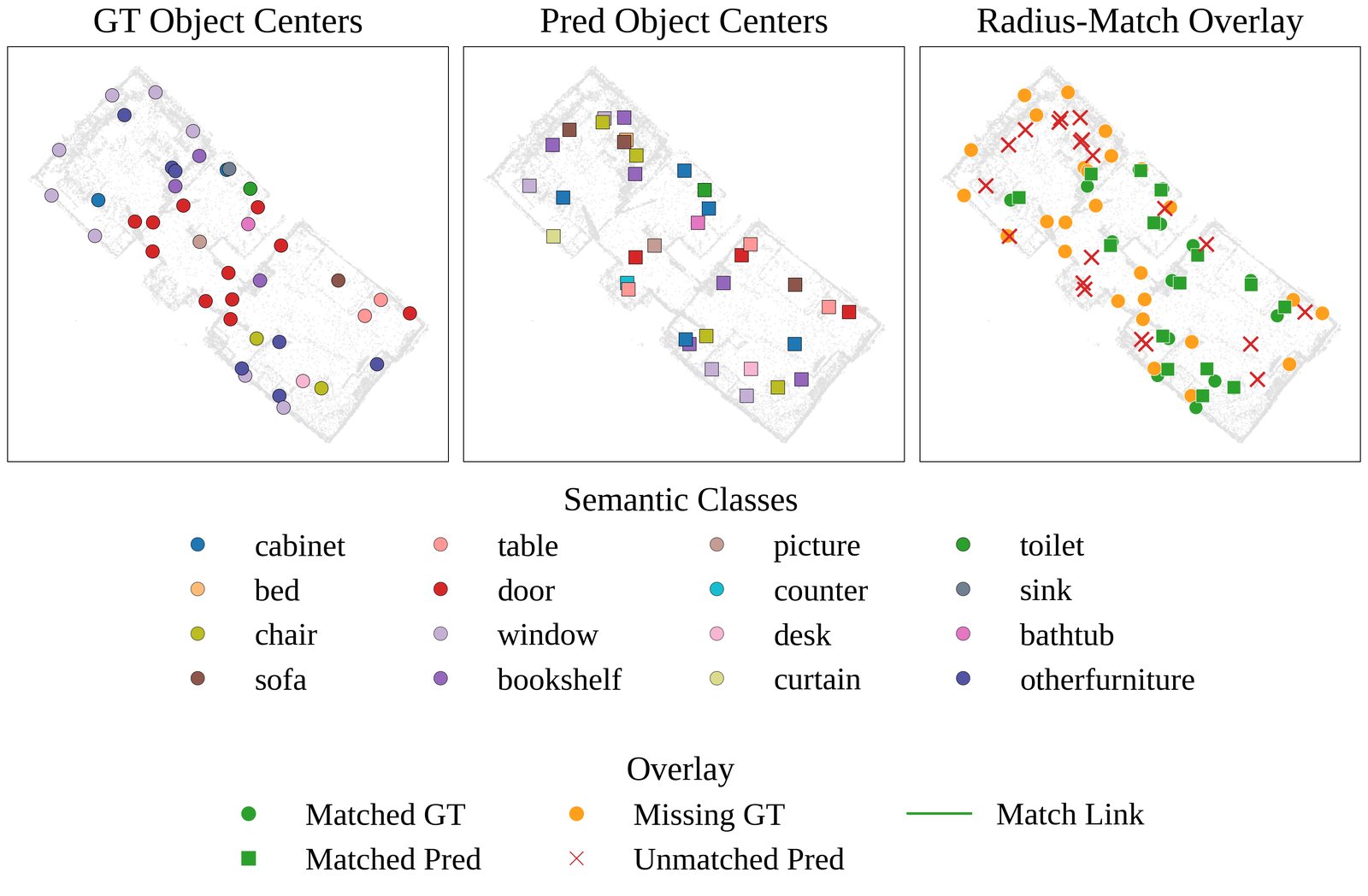
- 44.96 % global semantic mesh mIoU on evaluated ScanNet scenes fixed mapping backend, RGB plus IMU
Datasets: ScanNet, 7-Scenes, uHumans2, ITC building (own capture). Hardware: RTX 4080 Super for the full system. Jetson Orin NX 16GB for the exported perception model only.
Limitations
- Map quality is multi-objective and the improvements do not move together. On uHumans2 Apartment, adding depth and semantic components raises node F1 from 0.432 to 0.596 while making ATE worse, from 0.068 m to 0.075 m.
- On uHumans2 Office the best ATE (1.125 m, K=3) and the best node F1 (0.452, K=1) come from different configurations, so no single setting is best on every axis.
- The temporal alignment effect is non-monotonic in window length. Longer is not better.
- Evaluation is indoor throughout. Nothing here supports a claim about outdoor or large-scale environments.